You Need a Permit to Walk This Creek. It Costs Nothing.
Cienega Creek Natural Preserve near Vail sits 25 miles from downtown Tucson, where the creek runs underground all year and surfaces seasonally. Permit is free.
Twenty-five miles southeast of downtown, Pima County protects a stretch of creek that still runs in places and still holds native fish that have vanished from most of Arizona. The gate is a form, not a fee.
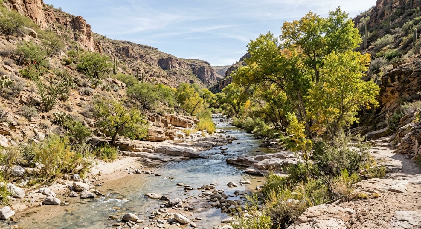
There is a creek 25 miles southeast of downtown Tucson that runs underground all year and surfaces in places when the season gives it water. Reaching it means leaving Interstate 10 at Exit 281, turning onto Marsh Station Road, and driving three miles northeast to a gravel lot that the traffic on I-10 passes at freeway speed without ever seeing. Walking down to that water legally requires a permit. The permit costs nothing. Hardly anyone gets one.
- 1986
- Year Pima County acquired the preserve to protect the creek's perennial flow
- $0
- Cost of the access permit, which is still required and takes two business days
- 25 miles
- From downtown Tucson southeast to the trailhead on Marsh Station Road
- 1921
- Year the concrete arch carrying Marsh Station Road over the creek was finished
The Permit Is the Whole Point
This is a preserve, not a park, and Pima County meters access on purpose. Entry is by permit, requested through an online form the Regional Flood Control District runs; the Arizona Trail Association advises applying at least two business days ahead. Groups larger than ten need a Facility Impact Permit, which the county says can take three or more days. Hours are sunrise to sunset, and there is no fee at any step. The exception is the Arizona National Scenic Trail: stay on the designated alignment and no permit is required.
What the County Bought in 1986, and Why
Pima County acquired the preserve in 1986 for a specific reason: to protect the creek's existing perennial stream flow, and with it the habitat of the Gila topminnow and other native aquatic species. The topminnow had been listed as endangered in 1967, undone by habitat loss and by non-native fish. This reach is now managed for self-supporting populations of Gila topminnow, roundtail chub and longfin dace, and — the rare part — the creek is free of non-native fishes. Arizona Game and Fish calls it the largest stream still supporting relict populations of the topminnow and the roundtail chub.
Cottonwood Shade, a Few Hundred Yards In
What makes the walk worth the paperwork is how fast the ground changes. You start in ocotillo and creosote scrub and drop into the shade of Fremont cottonwoods and Goodding's willows, with surface water present seasonally over a creek that runs underground the rest of the year. Birders come for Abert's towhee, canyon wren and gray hawk, with vermilion flycatchers and summer tanagers as the showpieces. Pima County lists the permitted uses plainly: birding, hiking, wildlife viewing, environmental education.
Go in Fall, and Read the Weather First
Flow here is seasonal and well watched — the Pima Association of Governments runs quarterly wet/dry mapping of the flow reaches, which it describes as one of the longest-term consistent datasets in the state. The Arizona Trail Association lists fall, winter and spring as the seasons for this stretch, and classes Cienega Creek as a seasonal water source whose water must be purified before use. Two county cautions, both literal: the area is subject to flash flooding, and the banks bring loose sand, unstable cuts and falling wood.
What to Sort Out Before You Drive
- Get the Permit First (Free, Two business days, Online form): Request access through Pima County's Cienega Creek permit form before you drive out. Free, but not optional and not same-day.
- Park on Marsh Station Road (Gabe Zimmerman trailhead, Sunrise to sunset, Small lots): The Gabe Zimmerman Davidson Canyon Trailhead is the main access, roughly three miles northeast of I-10 Exit 281. County pages disagree on capacity — 22 vehicles and eight horse rigs on one, about ten cars on another — so go early.
- Or Skip the Permit Entirely (Arizona Trail Passage 8, 13.9 miles, No permit needed): Passage 8 of the Arizona National Scenic Trail runs 13.9 miles from that trailhead north to the Saguaro National Park boundary, through the preserve and Colossal Cave Mountain Park. Stay on the alignment and no permit is required.
- Read the Rules First (Leashed dogs, Horses: Arizona Trail only, No fires or camping): Dogs on leash, and you pack out after them. Horses are allowed on the Arizona Trail alignment only. No fires, no camping, no alcohol, no collecting, no rappelling from the trestles.
The Road Out Is Older Than the Freeway
Marsh Station Road crosses Cienega Creek on a concrete arch the Arizona Highway Department began in 1920 and finished in 1921. The open-spandrel arch spans 146 feet, and ADOT calls it the longest open-spandrel bridge in the state. It carried U.S. 80 — the Borderland Highway — from 1926 to 1955, lost its through traffic to Interstate 10, and has been on the National Register of Historic Places since 1988. It carries local traffic now, which is the only reason you can still drive a 1921 highway bridge on the way to a hike.
Quick reference (September 1, 2026): Cienega Creek Natural Preserve, 16248 E. Marsh Station Road, Vail, about 25 miles southeast of downtown Tucson. Open sunrise to sunset; a free permit is required except for through-travel on the Arizona National Scenic Trail. Permit forms, parking counts and group rules are set by the Pima County Regional Flood Control District and have changed before — confirm before you drive out.
What This Is Worth on the Southeast Side
For anyone weighing Vail, Rincon Valley or Corona de Tucson, this is the kind of thing no property listing has a field for: county-held floodplain a few minutes off the I-10 frontage, bought in 1986 specifically to keep the water in the creek, and managed since for fish that cannot live anywhere the water stops. Whatever else changes on that side of the Tucson area, that stretch is not becoming anything else.
Sources
Pima County Regional Flood Control District — "Cienega Creek Natural Preserve" — pima.gov/3762/Cienega-Creek-Natural-Preserve — accessed September 1, 2026 (for the location 25 miles southeast of downtown Tucson, the address at 16248 E. Marsh Station Road in Vail, sunrise-to-sunset hours, the free permit requirement and the Arizona Trail exception, the parking areas, the flash-flooding and unstable-bank warnings, and the allowed activities).
Pima County — "Reservations and Permits" — pima.gov/3262/Reservations-and-Permits — accessed September 1, 2026 (for permits being free, the online Cienega Creek permit form, and the Facility Impact Permit required of groups larger than ten, which may take three or more days to issue).
Pima County Natural Resources, Parks and Recreation — "Cienega Creek Natural Preserve Rules and Regulations" — pima.gov — accessed September 1, 2026 (for the permit-and-sunrise-to-sunset access rule, leashed dogs, the prohibitions on alcohol, open fires, overnight camping, firearms, collecting natural or cultural resources, rappelling from trestles and paint-ball, and horses being confined to the Arizona Trail alignment).
Pima County — "Gabe Zimmerman Davidson Canyon Trailhead" — pima.gov/1326/Gabe-Zimmerman-Davidson-Canyon-Trailhead — accessed September 1, 2026 (for the trailhead address, dawn-to-dusk hours, the listed capacity of 22 vehicles and eight horse rigs, and its access to the preserve, Davidson Canyon and the Arizona Trail).
Arizona Trail Association — "Passage 8: Rincon Valley" — aztrail.org/explore/passages/passage-8-rincon-valley — accessed September 1, 2026 (for the 13.9-mile passage from the Gabe Zimmerman trailhead to the Saguaro National Park boundary, the route through Cienega Creek Natural Preserve and Colossal Cave Mountain Park, Cienega Creek as a seasonal water source requiring purification, fall through spring as the recommended seasons, the trailhead roughly three miles from I-10 Exit 281, the permit requirement for leaving the trail alignment, and the two-business-day application guidance).
Pima County — "Gila Topminnow" — pima.gov/744/Gila-Topminnow — accessed September 1, 2026 (for the county acquiring the preserve in 1986 to protect perennial stream flow and topminnow habitat, and for the species' 1967 endangered listing on account of habitat loss and non-native fish).
Arizona Game and Fish Department, Arizona Wildlife Conservation Strategy — "Cienega Creek: I-10 to Del Lago Diversion Dam" — awcs.azgfd.com/conservation-opportunity-areas/aquatic/cienega-creek-i-10-to-del-lago-diversion-dam — accessed September 1, 2026 (for the reach being managed for self-supporting populations of Gila topminnow, roundtail chub and longfin dace, for the watershed being free of non-native fishes, and for Cienega Creek being the largest stream still supporting relict populations of Gila topminnow and roundtail chub).
Pima Association of Governments — "Water Reliability" — pagregion.com/sustainability/water-quality/water-reliability — accessed September 1, 2026 (for PAG conducting quarterly wet/dry mapping of flow reaches and water quality measurements along these waterways, described as one of the longest-term consistent datasets in the state).
Arizona Birding Trail — "Cienega Creek Natural Preserve" — arizonabirdingtrail.com/site/cienega-creek-natural-preserve — accessed September 1, 2026 (for the transition from ocotillo-creosote desert scrub into Fremont cottonwood and Goodding's willow, the perennial underground flow with seasonal surface water, and the specialty birds including Abert's towhee, canyon wren, gray hawk, vermilion flycatcher and summer tanager).
Arizona Department of Transportation — "Cienega Creek Bridge: Arizona's longest open-spandrel bridge" — azdot.gov/adot-blog/cienega-creek-bridge-arizonas-longest-open-spandrel-bridge — accessed September 1, 2026 (for construction beginning in 1920 and finishing in 1921, the 146-foot open-spandrel arch, its standing as Arizona's longest open-spandrel bridge, its service on U.S. 80 — the Borderland Highway — from 1926 to 1955, its 1988 National Register listing, and its present role carrying local traffic on Marsh Station Road).
All details are current as of September 1, 2026; permit procedures, hours, parking capacity and trail conditions change, so readers should confirm current information with Pima County before relying on any single figure. This post is for informational purposes only and is not an offer to sell or a solicitation of an offer to purchase real estate. Kyle Berglund and Tierra Antigua Realty fully support and comply with the Fair Housing Act and the Equal Opportunity Act.
Topics
- Hidden Gems
- Cienega Creek
- Vail
- Rincon Valley
- Corona de Tucson
- Pima County
- Arizona Trail
- Birding
- Day Trip
- Tucson