Oro Valley's Petroglyph Walk Starts Under a Road Bridge
Where the Honey Bee Canyon Park petroglyphs are, how far up the wash to walk, and what to see at the 13-acre Honey Bee Village Hohokam preserve nearby.
Honey Bee Canyon Park's loop trails are on the town's July 2026 map. The carved boulder most people come for is not on any of them, and a Hohokam village preserve sits a mile away.
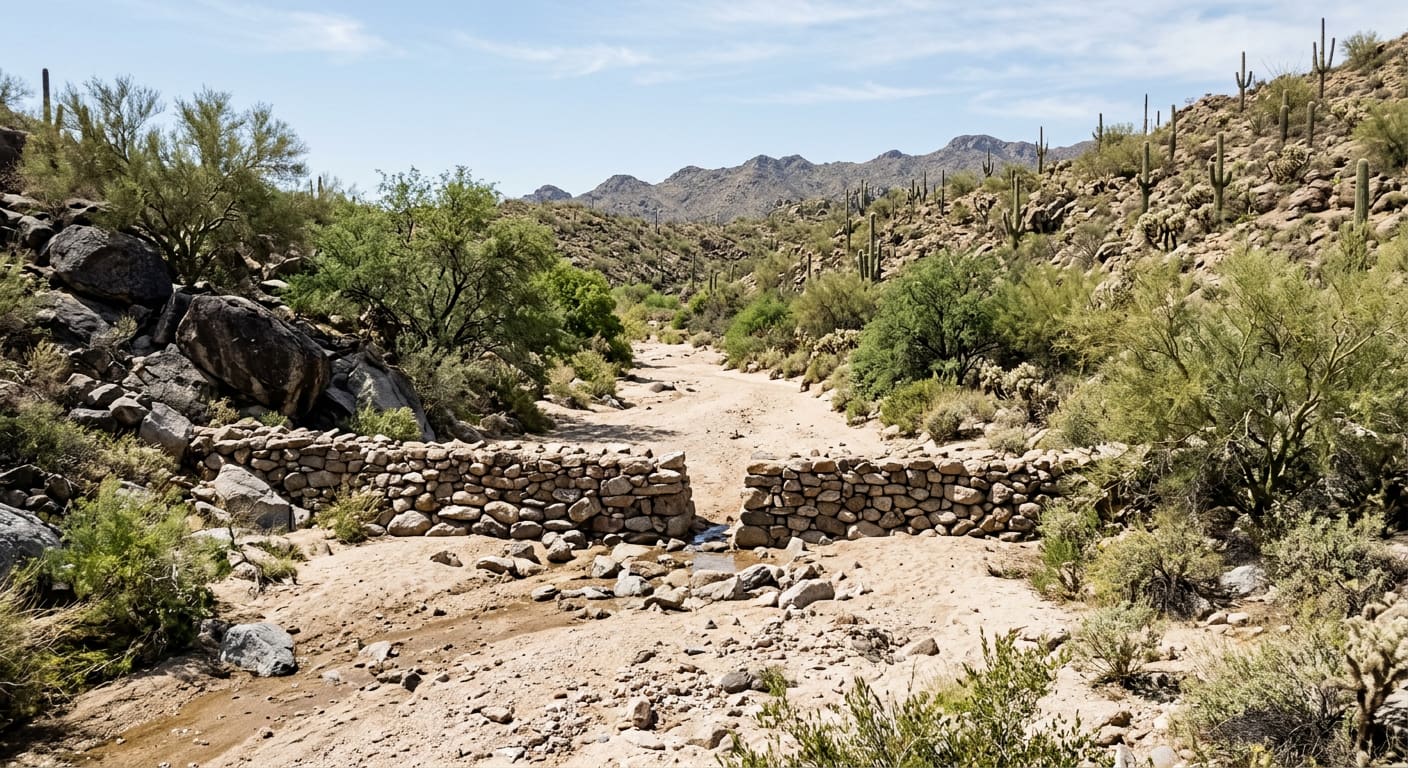
Most people who visit Honey Bee Canyon Park in Oro Valley walk its loop, eat at a ramada, and leave without seeing the thing the park is known for. The petroglyph boulder is not on the loop. It sits roughly a mile up the sandy wash, past an old stone dam, on the far side of the Rancho Vistoso Boulevard bridge. The town's trail map, updated in July 2026, marks the turnoff with two words — "To Petroglyphs" — and an arrow pointing off the edge of the page. With October cooling the wash enough for a midday walk, this is how to find it, and what to pair it with.
- 3 miles
- Hiking trail inside Honey Bee Canyon Park, per the Town of Oro Valley
- ~1 mile
- Walk up the wash from the trailhead to the petroglyph boulder
- 13 acres
- Honey Bee Village Archaeological Preserve, a Pima County property
- AD 650–1200
- Approximate span the Hohokam village was occupied
What the Park Has Inside the Boundary
The park is at 13880 N. Rancho Vistoso Blvd. and is open dawn to dusk. The town lists drinking fountains, grills, picnic tables, parking and accessible facilities, and the July 2026 map shows restrooms by the trailhead and two rentable ramadas, named Coyote and Roadrunner. The trail network is a set of short connected loops — the map labels segments between 0.04 and 0.55 miles — that drop from the parking lot into the wash and meet at a historic rock dam near the middle of the park.
That dam is not the one that marks the petroglyphs. Neither the town nor the Oro Valley Historical Society says who built the canyon's stone dams or when, and no record we could find names a builder, so treat any date you hear on the trail as a guess. What the map does make plain is the park's size: everything inside the boundary is a short walk, and the trip most visitors are missing starts where the boundary ends.
How Do You Find the Honey Bee Canyon Petroglyphs?
From the parking lot, follow the paved path in and take the trail toward the wash rather than toward the restrooms. The Oro Valley Historical Society's directions say to head for the Rancho Vistoso Boulevard overpass, walk under it, and keep going up the wash for about a mile. The footing is sand and the grade is nearly flat. Watch for a dam — a man-made stack of rock with an opening in it. Just past it, on the left, is a large stone balanced on another stone, with carved figures at about eye level.
Because of the way the rock faces, the figures may not be visible right away, so look twice before deciding you have the wrong boulder. If you reach a trough and a newer dam, you have gone too far; turn around. Out and back from the trailhead is roughly two miles of sand. Bring water, look at the carvings, and leave them alone.
What Is Honey Bee Village, and Can You Visit It?
No source we could find names who carved the boulder or when, and none ties it to a particular settlement. What is on the record is the village nearby. Honey Bee Village, a Hohokam settlement occupied from roughly AD 650 to 1200, sat near Moore Road and Rancho Vistoso Boulevard, a short drive from the park. When the land around it was developed, the rest of the site was excavated, and its 13-acre core was set aside as a permanent public preserve, assembled from a landowner's donation and 2004 voter-approved historic preservation bonds. Pima County opened it to the public in March 2018, after a blessing by a Tohono O'odham elder.
What you walk past is subtle by design. The preserve has never been excavated, and the hundreds of house sites inside it are left buried. A ballcourt shows as subtle raised berms; the stone foundations of a later walled compound are visible, and the mounds ringing the preserve are centuries of household debris. Even the erosion control is built on top of the ground — low rock check dams placed on the surface, because the agreement with descendant communities forbids digging. An interpretive trail gives the public a way through, and signs ask visitors to look at pottery fragments and leave them where they lie.
- Honey Bee Canyon Park (13880 N. Rancho Vistoso Blvd., Dawn to dusk, No fee): Three miles of trail, two rentable ramadas, restrooms, grills and drinking fountains. Parks and Recreation: 520-229-5050.
- The Petroglyph Boulder (~1 mile up the wash, Off the loop, Sand, nearly flat): Walk under the Rancho Vistoso Boulevard bridge and past the rock dam; the boulder is on the left.
- Honey Bee Village Preserve (Near Moore Road, 13 acres, Interpretive trail): A Hohokam village core, owned by Pima County and left unexcavated, with a ballcourt, compound foundations and trash mounds.
Doing Both in One Morning
Start at the village, where the interpretive trail and its signs explain what you are walking past. Then drive to the park and walk the wash with that in your head; the carvings read differently once you have walked ground a village stood on. For anyone weighing a move to the north end of Oro Valley, it is a concrete detail about the area: a free, town-maintained trail park and a county archaeological preserve sit within a mile of each other on Rancho Vistoso Boulevard, among the residential streets of the Rancho Vistoso master plan.
Quick reference (October 14, 2026): Honey Bee Canyon Park, 13880 N. Rancho Vistoso Blvd., Oro Valley, AZ 85755, open dawn to dusk; Oro Valley Parks and Recreation 520-229-5050. Honey Bee Village Archaeological Preserve, near Moore Road and Rancho Vistoso Blvd., Oro Valley. Confirm current hours and ramada availability with the town before you go.
Sources
Town of Oro Valley — "Honey Bee Canyon Park" — orovalleyaz.gov/Government/Departments/Parks-and-Recreation/Parks/Honey-Bee-Canyon-Park — accessed October 14, 2026 (for the address, dawn-to-dusk hours, three miles of trail, the historic rock dam, rentable ramadas, the listed amenities and the 520-229-5050 Parks and Recreation number). Town of Oro Valley — "Honey Bee Canyon Park" trail map, dated July 2026 — orovalleyaz.gov/files/assets/public/v/1/documents/parks-and-recreation/parks/honey-bee-canyon-trails-2026-update.pdf — accessed October 14, 2026 (for the Coyote and Roadrunner ramadas, the restrooms, the segment lengths, the dam's location and the "To Petroglyphs" spur under Rancho Vistoso Boulevard).
Oro Valley Historical Society — "Hike: helpful tips to find the Honey Bee Canyon petroglyphs" — ovhistory.org/hike-helpful-tips-to-find-the-honey-bee-canyon-petroglyphs/ — accessed October 14, 2026 (for the petroglyph sitting off the trail loop, the route under the overpass, the roughly one-mile sandy and flat walk, the rock-stack dam landmark, the balanced boulder on the left, and the trough and newer dam that mean you have gone too far).
Desert Archaeology — "On Having Nice Things: Preservation, Outreach, and the Honey Bee Archaeological Preserve" (R. J. Sliva) — desert.com/honey-bee/ — published March 23, 2018, accessed October 14, 2026 (for the AD 650–1200 occupation, the 13-acre preserve near Rancho Vistoso Boulevard and Moore Road, the interpretive trail, the ballcourt berms, compound foundations and trash mounds, the unexcavated preserve and its hundreds of residential structures, data recovery on the rest of the site, the March 2018 opening after a Tohono O'odham elder's blessing, the surface-placed check dams, and the signs asking visitors to leave artifacts). Archaeology Southwest — "Honey Bee Village" — archaeologysouthwest.org/projects/honeybee — accessed October 14, 2026 (for the 13-acre core as a permanent public preserve run by Pima County, the landowner's donation and the 2004 voter-approved historic preservation bonds).
All details are current as of October 14, 2026; hours, ramada rentals and trail conditions change, so confirm with the Town of Oro Valley before visiting. This post is for informational purposes only and is not an offer to sell or a solicitation of an offer to purchase real estate. Kyle Berglund and Tierra Antigua Realty fully support and comply with the Fair Housing Act and the Equal Opportunity Act.
Topics
- Hidden Gems
- Honey Bee Canyon Park
- Honey Bee Village
- Petroglyphs
- Hohokam
- Oro Valley
- Rancho Vistoso
- Hiking