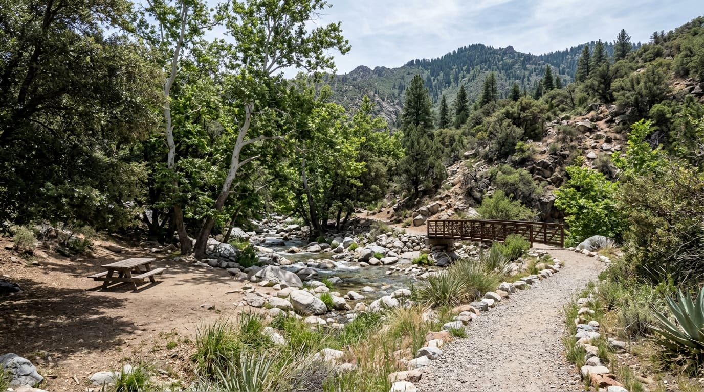
Driving Through Madera Canyon Is Free. Parking Is $8.
Madera Canyon charges $8 per vehicle to park at its developed sites, not to enter the canyon. What each lot has, where the water is, and which trail climbs.
The Forest Service charges by the lot, not at a gate, and its own pages disagree about which lots. The five stops run from an accessible concrete path at the bottom to a waterless trailhead at 5,463 feet.
The number most people bring home from Madera Canyon is $8, and most of them think it bought the canyon. It did not. The Forest Service's own page for the canyon entrance station says there is no fee to drive Madera Canyon Road — the charge is for parking, and it starts when you pull into a developed site. The climb from desert floor through grassland into oak and sycamore, the part that makes people stop the car, costs nothing.
- $8
- Per vehicle, per day to park at a developed Madera Canyon site
- 5,463 ft
- Elevation at the Mount Wrightson Picnic Area, where the road ends
- 250+
- Bird species the Forest Service records in the canyon
- 13.5 mi
- From I-19 Exit 63 in Green Valley to the top lot
The Fee, and the One Page That Disagrees About It
Eight dollars a vehicle for a day, $10 for a week. A Coronado National Forest annual pass is $40 and covers every fee site on the forest, Sabino Canyon included, so it pays for itself on the fifth trip. Interagency America the Beautiful passes work too, and whatever you use goes on the driver's side of the dashboard. Where the published guidance splits is which lots charge: the entrance station page names only the Proctor and Mount Wrightson trailheads, while the Forest Service's own pages for the Whitehouse and Madera picnic areas each list the same $8 and $10. Assume every developed lot charges and you will not be wrong. Payment is the second soft spot — the Forest Service says cash, check, or a pass bought through Recreation.gov, and Friends of Madera Canyon says the machines take credit cards only. Carry both.
Five Places to Stop, Nine Hundred Feet Apart
- Proctor Picnic Area and Trailhead (First lot, Accessible path, Water): About 11 miles east of I-19, and the stop to pick if somebody in the car is not walking far. The accessible path is concrete, roughly an eighth of a mile with benches, ending at a steel bridge over Madera Creek. Vault toilets, potable water, tables and two ramadas, all built to accommodate visitors with disabilities. Day use 6 a.m. to 10 p.m., no trailers or pack animals. Friends of Madera Canyon volunteers staff a visitor information station here Fridays through Sundays — 8 a.m. to noon through September, then 10 a.m. to 2 p.m. from October.
- Whitehouse Picnic Area (Group ramada, Nature Trail, No water): Named for the ruins of a white adobe house built at the canyon mouth in the 1880s. Tables under mesquite and oak, a large group ramada, vault toilets, and no potable water — fill up at Proctor first. The Madera Nature Trail starts here, paved and accessible in sections, and the creek overlooks are where the Forest Service says to watch for Coues white-tailed deer, javelina and coatimundi.
- Madera Picnic Area and Trailhead (5,500 ft, 11 creekside sites, Bear-proof bins): Eleven sites strung along Madera Creek at 5,500 feet, about 13 miles southeast of Green Valley by way of Continental Road. Vault toilets, potable water, and bear-proof trash bins, which tell you what else uses the canyon. The Dutch John and Bog Springs trails leave from here.
- Mount Wrightson Picnic Area and Trailhead (5,463 ft, Road's end, Four trails): The top lot, 13.5 miles east of Exit 63, at 5,463 feet. Shaded tables with fire grills, accessible vault toilets, two parking areas, no potable water. Four trails start here, two of them National Recreation Trails: Old Baldy #372, the Super Trail #134, Vault Mine and the Madera Nature Trail.
- Bog Springs Campground ($20 a night, Open year-round, No hookups): The canyon's only campground — $20 a night single, $40 double, two vehicles and ten people per site, no RV hookups, 14 nights in any 60-day period. Quiet hours 10 p.m. to 6 a.m. Its potable water was listed as temporarily unavailable when this was written, with the Madera and Proctor spigots as the substitute.
What the Monsoon Did, and What It Does Not Tell You
Madera Creek is storm-fed, which is the argument for going after a wet monsoon rather than in November, and this year the storms arrived late. National Weather Service Tucson's monthly reviews have July at 0.70 inches at Tucson International Airport — 1.51 below normal, the 11th driest July on record — and then August at 3.21 inches against a 1.98-inch normal, the 26th wettest. Season to date through August the airport had 4.96 inches, above normal and the 52nd wettest monsoon on record. Those are the airport's numbers, though, gauged on the desert floor north of the Santa Ritas rather than anywhere in the canyon: they establish that the region's monsoon ran wet, not that water is moving in Madera Creek on the day you drive up. No public stream gauge reports the creek, so treat a running creek as worth asking about at the Nogales Ranger District, (520) 761-6000, rather than as something this year's rainfall guarantees. The birds are the other reason to come. The Forest Service counts more than 250 species in the canyon and 15 hummingbirds; Friends of Madera Canyon lists 16 seen regularly, from the common Broad-billed, Anna's, Costa's and Black-chinned up through Rivoli's and the Blue-throated Mountain Gem, with Violet-crowned, White-eared, Lucifer, Berylline and Plain-capped Starthroat as the rarities that fill the pullouts. Santa Rita Lodge keeps feeders and a shaded, wheelchair-accessible viewing area, and you need not be a guest — the lodge says parking is free if you are there for the viewing area rather than a trailhead.
If You Came for the Summit
Mount Wrightson finishes at 9,453 feet, close to 4,000 above the trailhead lot, and two trails go up from it. The Forest Service's own comparison is the useful one: Old Baldy #372 is the shortest and steepest, holding a northerly aspect and staying in the trees almost its whole length to Baldy Saddle, where the Crest Trail covers the last mile to the top. The Super Trail #134 is longer at a more moderate gradient, on a south-facing slope. The two cross in a figure eight, which is why most people come down the one they did not go up. Neither is a casual afternoon. If that is not the day you had in mind, Friends of Madera Canyon puts the Madera Creek Trail from Proctor to the amphitheater at 1.7 miles and 550 feet of gain, on the same water.
Quick reference (September 5, 2026): Madera Canyon, Santa Rita Mountains, Coronado National Forest — I-19 south from Tucson to Exit 63 (Continental Road) in Green Valley, then east on Madera Canyon Road, about 11 miles to Proctor and 13.5 to the Mount Wrightson lot. No fee to drive the road; parking at developed sites is $8 per vehicle daily, $10 weekly, and the Coronado annual pass is $40. Interagency passes accepted, displayed on the driver's side dashboard. Picnic areas are day use, 6 a.m. to 10 p.m. Potable water at Proctor and Madera only. Bog Springs Campground $20 a night. Nogales Ranger District, (520) 761-6000. Confirm fees, hours and water before you drive out.
What to Bring, and What Not to Expect
There is no visitor center, no concession and no cell coverage worth relying on, and the two water spigots are both in the lower half of the canyon. Leashed pets are fine in the developed areas; overnight parking outside the campground is not. The canyon climbs from about 2,700 feet at Green Valley to roughly 5,500 at the upper picnic areas, and Friends of Madera Canyon puts the higher elevations near 20 degrees below the desert floor — in early September that is the entire reason to make the drive. Go in the morning anyway. The top lot fills on a Saturday long before any published closing time matters.
Sources
USDA Forest Service, Coronado National Forest — "Madera Canyon Entrance Station" — fs.usda.gov/r03/coronado/recreation/madera-canyon-entrance-station — accessed September 5, 2026 (for the statement that no fee is charged to drive through Madera Canyon and that day-use parking fees apply at the Proctor and Mount Wrightson trailheads, for the Friends of Madera Canyon visitor information station operating Fridays through Sundays year-round at 8 a.m. to noon April through September and 10 a.m. to 2 p.m. October through March, and for the Nogales Ranger District number (520) 761-6000). USDA Forest Service, Coronado National Forest — "Mount Wrightson Picnic Area and Trailhead" — fs.usda.gov/r03/coronado/recreation/mount-wrightson-picnic-area-and-trailhead — accessed September 5, 2026 (for the 5,463-foot elevation, the 6 a.m. to 10 p.m. day-use hours, the $8 daily and $10 weekly per-vehicle fee payable on site by cash or check or online through Recreation.gov, the shaded picnic tables with fire grills, accessible vault toilets, absence of potable water, two parking areas, the four trails including Old Baldy #372 and the Super Trail #134 as National Recreation Trails, the more-than-250 bird species and 15 hummingbird species, and the directions of I-19 south about 35 miles to Exit 63 at Continental Road then roughly 13.5 miles east). USDA Forest Service, Coronado National Forest — "Proctor Picnic Area and Trailhead" — fs.usda.gov/r03/coronado/recreation/proctor-picnic-area-and-trailhead — accessed September 5, 2026 (for the roughly 11 miles east of I-19, the $8 daily and $10 weekly fee, the 6 a.m. to 10 p.m. year-round day-use hours, the vault toilets, potable water, picnic tables and shade and interpretive ramadas built to accommodate visitors with disabilities, the Madera Nature Trail #88 access, and the prohibitions on trailers, pack animals and overnight camping). USDA Forest Service, Coronado National Forest — "Whitehouse Picnic Area" — fs.usda.gov/r03/coronado/recreation/whitehouse-picnic-area — accessed September 5, 2026 (for the $8 daily and $10 weekly fee, the tables under mesquite and oak, the large group ramada, vault toilets and lack of potable water, the naming of the site for the ruins of a white adobe house built at the mouth of the canyon in the 1880s, the paved accessible sections of the Madera Nature Trail, and the Coues white-tailed deer, javelina and coatimundi seen from the creek overlooks). USDA Forest Service, Coronado National Forest — "Madera Picnic Area and Trailhead" — fs.usda.gov/r03/coronado/recreation/madera-picnic-area-and-trailhead — accessed September 5, 2026 (for the 5,500-foot elevation, the 11 individual sites along Madera Creek, the roughly 13 miles southeast of Green Valley via Continental Road, the vault toilets, potable water and bear-proof trash bins, the Dutch John Trail #91 and Bog Springs Trail #156 connections, and the $8 daily and $10 weekly fee). USDA Forest Service, Coronado National Forest — "Bog Springs Campground" — fs.usda.gov/r03/coronado/recreation/bog-springs-campground — accessed September 5, 2026 (for the $20 single and $40 double nightly rates, the year-round season, the limit of two vehicles and ten persons per site, the absence of RV hookups, the 14-day stay limit per 60-day period, the 10 p.m. to 6 a.m. quiet hours, and the notice that potable water was temporarily unavailable with the Madera and Proctor picnic area spigots as the alternative). USDA Forest Service, Coronado National Forest — "Passes and Permits" — fs.usda.gov/r03/coronado/passes — accessed September 5, 2026 (for the $40 Coronado National Forest annual pass covering forest recreation sites, the acceptance of Interagency America the Beautiful passes, and the availability of passes through Recreation.gov and Forest Service offices). Friends of Madera Canyon — "About Madera Canyon" — friendsofmaderacanyon.org/aboutmc — accessed September 5, 2026 (for the $8 day fee and the credit-card-only electronic pass machines at the Proctor parking area trailhead and the Mount Wrightson picnic area, for the elevation range of about 2,700 feet at Green Valley to about 5,500 feet in the upper canyon, for the roughly 20-degree temperature difference between the higher elevations and the desert floor, for Madera Canyon Road as the paved route in by way of Continental and Whitehouse Canyon roads, for the sunrise-to-sunset operating window, and for the eighth-mile concrete accessible Proctor trail with benches ending at a steel bridge over Madera Creek). Friends of Madera Canyon — "Birding" — friendsofmaderacanyon.org/birding — accessed September 5, 2026 (for the more-than-250 species count, the 16 regularly seen hummingbird species named as Broad-billed, Anna's, Costa's, Black-chinned, Rivoli's, Blue-throated Mountain Gem, Broad-tailed, Rufous, Allen's, Calliope, Violet-crowned, White-eared, Lucifer, Berylline, Plain-capped Starthroat and Ruby-throated, and for the 9,453-foot summit of Mount Wrightson). Friends of Madera Canyon — "Hiking" — friendsofmaderacanyon.org/hiking — accessed September 5, 2026 (for the Madera Creek Trail at 1.7 miles and 550 feet of elevation gain between the Proctor and amphitheater trailheads). USDA Forest Service, Coronado National Forest — "Old Baldy Trail #372" — fs.usda.gov/r03/coronado/recreation/trails/old-baldy-trail-372 — accessed September 5, 2026 (for Old Baldy as the shortest and steepest route to the summit, its northerly aspect and tree cover, the switchbacks to Baldy Saddle and the Crest Trail's final mile, the 9,453-foot summit of Mount Wrightson, and the directions of I-19 to the Continental Road/Madera Canyon exit then about 13.5 miles to the Mount Wrightson Picnic Area). USDA Forest Service, Coronado National Forest — "Super #134 Loop" — fs.usda.gov/r03/coronado/recreation/super-134-loop — accessed September 5, 2026 (for the Super Trail as the longer route at a more moderate gradient on a south-facing slope, and for the two trails forming a figure eight; note that this page gives the summit as 9,543 feet where the Old Baldy page and Friends of Madera Canyon both give 9,453, and this post uses the latter). Santa Rita Lodge — "Birds & Wildlife" — santaritalodge.com/things-to-do/birding-and-wildlife.html — accessed September 5, 2026 (for the feeders and the shaded, wheelchair-accessible viewing area open to visitors, and for free parking when visiting the viewing area rather than hiking). National Weather Service, Tucson — "Tucson Monthly & Seasonal Reviews for 2026" — weather.gov/twc/2026MonthlyReviews — accessed September 5, 2026 (for July 2026 at 0.70 inches at Tucson International Airport, 1.51 inches below normal and the 11th driest July on record; August 2026 at 3.21 inches against a 1.98-inch normal and the 26th wettest August on record; and monsoon-to-date rainfall of 4.96 inches through the end of August, above normal and the 52nd wettest monsoon on record). Fees, hours, water availability and pass policies change; confirm with the Nogales Ranger District before visiting. This post is for informational purposes only and is not an offer to sell or a solicitation of an offer to purchase real estate. Kyle Berglund and Tierra Antigua Realty fully support and comply with the Fair Housing Act and the Equal Opportunity Act.
Earlier coverage
- Two Weeks Left in Madera Canyon's Best Birding Window — May 3, 2026
Topics
- Things to Do
- Madera Canyon
- Santa Rita Mountains
- Coronado National Forest
- Green Valley
- Sahuarita
- Birding
- Hiking