Fifty Square Miles Inside Tucson City Limits, and Almost Nothing on Them
Over fifty square miles inside Tucson's city limits are undeveloped State Trust Land. The city authorized an area plan for the Southlands on September 9, 2026.
The Mayor and Council authorized an area plan for the Southlands on September 9, 2026. The plan it will replace was adopted in 1995, and the habitat maps underneath it come from a 1986 study last updated in 1994.
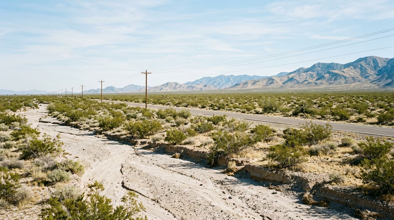
A fifth of the City of Tucson has almost nothing built on it, and most people who live here have never driven across it. South and southeast of Tucson International Airport, inside the city limits, in Wards 4 and 5, sits an area the city's general plan calls the Southlands — over fifty square miles, almost entirely undeveloped. The Planning and Development Services Department puts it at close to 20 percent of the land inside Tucson's boundary. On September 9, 2026, the Mayor and Council directed that department to begin a public engagement process and write an area plan for it. It is the first attempt to replan the whole of it since 1995.
- 50+ sq mi
- Undeveloped land in the Southlands, inside city limits
- ~20%
- Share of Tucson's land area the Southlands covers
- Sept. 9, 2026
- Mayor and Council authorized the area plan process
- 1995
- Adoption year of the plan that governs the area today
Where It Actually Is
The boundary is written down, and its edges are all roads you already use. The Southlands is generally bounded by Interstate 10 and Tucson International Airport on the north, the Pima Mine Road and Andrada Road alignments on the south, Houghton Road and Wentworth Road on the east, and Nogales Highway on the west. If you have driven I-10 toward Benson, dropped down Nogales Highway past the airport, or come up Houghton from Sahuarita Road, you have been along its perimeter without entering it. The city's framing of why this matters to people who will never live out there is one sentence: policy decisions guiding development in the Southlands will affect the entire Tucson community.
One Owner, Which Is Most of the Explanation
Almost all of the Southlands belongs to a single entity: the Arizona State Land Department. State Trust Land was assigned to Arizona to fund a set of public beneficiaries, the largest of which is the state's K-12 public schools, and the department's mandates come from Arizona's Enabling Act, the state Constitution and statute. The practical consequence is a sentence the department's own consultants put in writing last year: all State Trust Land must be sold at public auction. That is the rule for trust land on its way to a private owner, and it is worth reading as a rule about how the land changes hands rather than as a promise that every acre eventually will. The Enabling Act says trust land shall not be sold or leased except to the highest and best bidder at a public auction, and it allows leases of up to ten years for grazing, agricultural, commercial and domestic purposes — so the department can hold and lease ground instead of selling it. What the auction requirement rules out is the quiet version of either: no assemblage, no option contract, no builder walking parcels with a checkbook. Because it cannot know who will eventually buy, the department entitles land with the city first and sells second, leaving detailed engineering to the auction winner. The flip side is the city's own argument: one owner across fifty square miles makes coordinated master planning possible where fractionalized private ownership never could.
The Other Reason Is Water
Geography did the rest. The floodplains out here are broad and shallow rather than incised, and the planning documents are blunt about the cost of that: developable land is constrained to isolated pockets, and reaching those pockets requires extensive infrastructure. Redrawing the floodplain limits is itself restricted, because the vegetation inside them is protected. The approach now proposed in the first focal area is to consolidate those broad sheet flows into narrower enhanced corridors — fewer, deeper channels carrying more water — pitched at once as flood control, as a way to concentrate moisture enough to support better riparian vegetation, and as a way to keep a wildlife route open through the middle. Three claims for one grading plan, and the substance of the next two years of hearings.
The Plan in Force Dates to 1995
The Rincon/Southeast Subregional Plan was adopted by Mayor and Council in 1995, built on the 1992 Pima County Comprehensive Plan. It named the area's rural character, flagged the industrial and employment potential between I-10 and I-19, and then largely sat. The environmental layer underneath it is older still: the plan's Resource Conservation washes trace back to Dr. William Shaw's Critical and Sensitive Wildlife Habitats of Eastern Pima County, completed in 1986 and updated in 1994, mapped from USGS aerial photography at a scale of one inch to a thousand feet. Those areas were only ever mapped within two of the plan's map details, so washes across the rest of the Southlands are not subject to the policy at all. Add three decades of drought and far better imagery, and the 1995 lines and the ground no longer agree.
One Piece Is Already Moving
The first focal area is called Rita 10 — roughly 8,361 acres of State Trust Land between Interstate 10 and Wilmot Road, north of Dawn Road and south of Voyager Road, chosen because it fronts I-10 and the future Sonoran Corridor. In 2024 the city amended the 1995 plan to create Special Area Policy 1-05 for it, converting rural land use designations to urban and industrial ones and permitting the washes to be modified and consolidated. A Planned Community Development for the site went to the city's Stormwater Technical Advisory Committee in 2025. That sequence — amend the plan, create a special area, entitle, auction — is the template the rest of the Southlands would follow.
What It Means If You Live or Are Buying on the South Side
Two honest things. First, timing: this is Phase One — information gathering, economic and environmental analysis, and a working group of stakeholders and residents. The city expects the heaviest public feedback in Phase Two, anticipated in early 2027. Nothing about a house you buy this autumn changes because of September 9, but the working group and those Phase Two meetings are the version of this process you can walk into. Second, scale: this is the largest single land-use question the City of Tucson has, and it sits immediately south of the airport and the I-10 corridor where the southeast side's newer subdivisions already are. If you are shopping out there, ask one question about any specific parcel — which plan and which land use designation govern it today — and get the answer from the city, not from a 2027 document that does not exist yet.
Sources
City of Tucson, Planning & Development Services — "Southlands Area Plan" — tucsonaz.gov/Departments/Planning-Development-Services/Planning-Initiatives/Southlands-Area-Plan — accessed September 23, 2026 (for the approximately 50 square miles, the almost 20 percent of land within city limits, Wards 4 and 5, the September 9, 2026 Mayor and Council authorization, Phase One information gathering and the working group, Phase Two anticipated in early 2027, and the statement that policy decisions guiding development there will affect the entire Tucson community). City of Tucson, Planning & Development Services — "City Moves Forward on Southlands Planning Process" — tucsonaz.gov/Departments/Planning-Development-Services/PDSD-News/City-Moves-Forward-on-Southlands-Planning-Process — accessed September 23, 2026 (for the Mayor and Council direction to PDSD and the two-phase engagement structure). Arizona State Land Department, prepared by The Planning Center, Psomas and Lazarus & Silvyn, P.C. — "Rincon/Southeast Subregional Plan RITA 10 Plan Amendment Narrative," filed with the City of Tucson Planning Commission — tucsonaz.gov/files/sharedassets/public/v/1/pdsd/documents/boards-committees-commissions/planning-commission/02.07.24/rita-10-rssp-amendment-narrative.pdf — accessed September 23, 2026 (for the Southlands boundary description; the over fifty square miles of undeveloped land; ASLD as the predominant owner and the master-planning argument that follows from it; RITA 10 at approximately 8,300 acres between Interstate 10 and Wilmot Road, north of Dawn Road and south of Voyager Road, and its location along I-10 and the future Sonoran Corridor; the shallow floodplains constraining developable land to isolated pockets and requiring extensive infrastructure; the restriction on altering floodplain limits because of protected vegetation; the proposal to consolidate flows into enhanced corridors for flood control, vegetation and wildlife movement; the 1995 adoption of the Rincon/Southeast Subregional Plan based on the 1992 Pima County Comprehensive Plan and its recognition of the area's rural character and employment potential between I-10 and I-19; the Shaw Critical and Sensitive Wildlife Habitats of Eastern Pima County study of 1986 updated in 1994, mapped from USGS aerial photography at one inch to 1,000 feet; and the Resource Conservation areas being mapped only within Map Details #4 and #8). Psomas to the City of Tucson — "Rita 10 Planned Community Development STAC Review," letter dated June 12, 2025, in the Stormwater Technical Advisory Committee packet of July 18, 2025 — tucsonaz.gov/files/sharedassets/public/v/1/pdsd/documents/boards-committees-commissions/stac/071825/rita-10-stac-review-letter.pdf — accessed September 23, 2026 (for the 8,361 acre figure; the statement that State Trust Land was assigned to Arizona to fund public beneficiaries, the largest being Arizona's K-12 public schools; ASLD's mandates in the Enabling Act, Constitution and statute; the requirement that all State Trust Land be sold at public auction; the entitle-then-sell sequence; and the City's 2024 adoption of the RSSP amendment establishing Special Area Policy 1-05). Arizona Enabling Act, Act of June 20, 1910, ch. 310, section 28 — codes.findlaw.com/az/enabling-act/az-rev-st-enabling-act-sec-28 — accessed September 23, 2026 (for trust land not being sold or leased except to the highest and best bidder at a public auction, and for leases of up to ten years for grazing, agricultural, commercial and domestic purposes). Land use designations, plan boundaries and entitlements change, and they are determined parcel by parcel — confirm the plan, zoning and designation that apply to any specific property with the City of Tucson Planning and Development Services Department before relying on them. This post is for informational purposes only and is not an offer to sell or a solicitation of an offer to purchase real estate. Kyle Berglund and Tierra Antigua Realty fully support and comply with the Fair Housing Act and the Equal Opportunity Act.
Topics
- Local Insights
- Southlands
- State Trust Land
- Land Use Planning
- Southeast Tucson
- Tucson