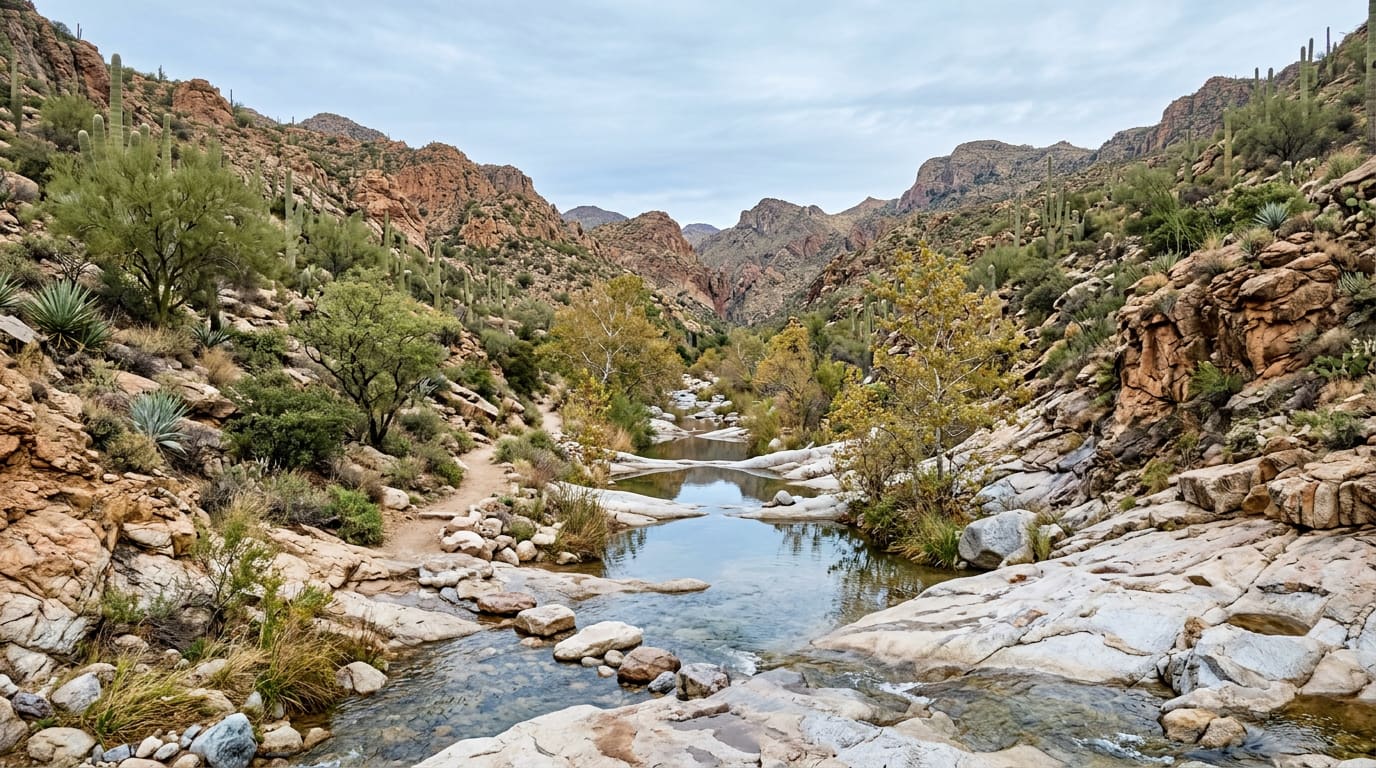
Ventana Canyon Trail Starts in a Resort Staff Lot and Climbs to Maiden Pools
Where the Ventana Canyon trailhead is, how far Maiden Pools and The Window are, the Pusch Ridge bighorn rules, and what it means for Ventana Canyon owners.
After Tucson's wettest start to November on record, the front-range canyon above Ventana Canyon is worth knowing: where to park, how far the pools are, and the wilderness rules that come with the walk.
The way into one of the Santa Catalinas' front-range canyons begins behind a resort's staff parking. Pima County's listing for the Ventana Canyon Trailhead, at 6601 N. Resort Drive, places it "at the back of the Ventana Canyon Resort's employee parking area." The lot holds 25 vehicles and is open sunrise to sunset. From it, a 5,200-foot access trail controlled by the county, most of which follows Ventana Wash, links the trailhead with the national forest. The Forest Service says no fee or pass is required. If you have driven past the resort entrance for years without knowing a public trailhead was in there, you are the reader this post is for.
- 25
- Vehicles the county trailhead lot holds
- 2.5 mi
- One way to Maiden Pools, per the Forest Service trail guide
- 7 mi
- One way to The Window
- 1.47 in
- Rain at Tucson's airport on November 1 and 2, a record for those days
The Rain That Reached the Washes
The reason to write about this canyon now is the weekend that just passed. The Arizona Daily Star reports that Tucson International Airport recorded 1.47 inches of rain across November 1 and 2, the wettest first two days of November on record. The previous mark was 0.48 inch, set in 1923. Counting the 72 hours from October 30 through November 1, the city's official gauge took 2.16 inches. Gauges in the mountains took far more: one in the Sabino Basin, higher in the Santa Catalinas, logged 7.95 inches over those 72 hours.
The front range got its share. The Star, citing the National Weather Service, reported that Oro Valley and the Catalina Mountains received more than 2 inches between about 8 a.m. and 2 p.m. on Sunday, November 1. KOLD quoted a meteorologist saying the area had picked up almost triple a typical November's rain in about a day and a half. It also reported runoff from the Catalinas still flowing into area washes on Monday, and crews expecting at least two weeks of debris clearing.
That matters on this trail more than most, because the trail is the wash for much of its first stretch. The Forest Service guide to the area's front-range trails describes the Ventana route as following the drainage, "crossing the wash many times as it gradually gains elevation." During the storm, the Forest Service warned visitors not to cross washes or canyons during or immediately after rain, because conditions change quickly and rising water is dangerous. That warning describes exactly what this trail asks you to do, repeatedly. Give it a dry day or two after any storm, and turn around at a crossing that is running fast.
From the Staff Lot to Maiden Pools
The Coronado National Forest trail guide, revised March 2025, lays the route out plainly. Ventana Trail #98 starts along private property, then turns north into the canyon. It reaches the wilderness boundary at 1 mile and Maiden Pools at 2.5 miles. At mile 2 it climbs a series of switchbacks before dropping back into the canyon. Past the pools it keeps climbing to a junction with Finger Rock Trail #42 at 6.7 miles and The Window at 7 miles. The Window is an opening through solid rock near the top of one of the front-range peaks.
Most people stop at the pools. The Forest Service's own trail page calls Maiden Pools "a popular turnaround spot" and notes the small pools along the creek are good for birdwatching. It also warns that the route has several sections of steep, rocky switchbacks and gets harder to follow the higher it goes. A 5-mile round trip to the pools is a real morning, not a stroll. The Window is a full-day climb, and the Forest Service rates fall through spring as the season for these trails, with summer bringing extreme heat and flash floods.
Pack water. The trail guide lists drinking water at the Pima Canyon and Finger Rock trailheads, and does not list it at Ventana. It also notes that these lots fill quickly, and that overnight parking requires a free permit from Pima County. With 25 spaces, a weekend morning after a rain is when to have a backup plan.
The Rules That Come With the Wilderness
A mile up, the trail enters the Pusch Ridge Wilderness, which the Forest Service puts at 56,919 acres. The canyon is also inside the Bighorn Sheep Management Area. Desert bighorn lived in these mountains for thousands of years before disease and development decimated them in the 1900s. The Forest Service says reintroduction efforts since 2013 have let new herds repopulate the range, and suggests scanning the cliffs above the canyon for them.
Protecting them sets the rules. Pets are prohibited on all trails in the management area, and the county's trailhead listing says flatly that dogs are not permitted on the trails. From January 1 through April 30, lambing season, it is prohibited to travel more than 400 feet from official Forest Service trails. The Forest Service's trail page also caps group size at 15 people by day and 6 at night. None of this is a reason to skip the hike. It is a reason to leave the dog at home and stay on the tread from New Year's Day onward.
What a Wilderness Trailhead Next Door Means for Ventana Canyon Owners
This site's Ventana Canyon page describes a gated resort-and-golf community of about 1,100 acres in the Catalina foothills. It grew up around the Loews Ventana Canyon Resort, which opened in 1984 and was laid out to keep the property's roughly 3,500 mature saguaros and its riparian washes rather than clear them. Today there are roughly 700 residences in a series of gated enclaves. They range from the Ventana Canyon Golf Villas, built around 1990, and condominium complexes to single-family homes and custom estates on the canyon slopes. Architecture runs to earth-toned Southwest contemporary, Santa Fe and adobe-inspired styles.
The HOA structure is the detail buyers most often miss. The Ventana Canyon Community Association is the master association and governs the main gate and the private roads. The place page counts about 584 homes inside the main gate and another 104 outside it. Most sub-neighborhoods have their own association as well, so owners typically pay two layers of dues covering different services.
The trail changes the picture in two practical ways. First, a mile up the canyon from the trailhead, the land is federal wilderness, which by law stays undeveloped. What sits above the community is protected by that designation rather than by an HOA rule or a zoning map. Second, the trailhead is public and county-run, so the people using it on a Saturday morning are not all residents. That is the trade for owning beside a wilderness access point. For an owner, the same washes the resort was planned around are where storm runoff goes, and a week like this one is a sensible time to ask your association which drainage it maintains. For what homes in Ventana Canyon cost and how the area has changed, see this site's Ventana Canyon page.
Before You Park Behind the Resort
Check Pima County's Notices and Closures page before you drive up; the trailhead listing points there for any closures. Start early, carry more water than you think a 5-mile walk needs, and plan to be back at the car by sunset, when the lot's hours end. Expect to get your feet wet or to turn around at a running crossing in the days after a storm. If the pools are your goal, they are the payoff: a creek, cupped in rock, two and a half miles from a parking lot most of the city has never noticed.
Sources
Pima County — "Ventana Canyon Trailhead" — https://www.pima.gov/ventana-canyon-trailhead — accessed November 5, 2026
USDA Forest Service, Coronado National Forest — "Ventana Trail #98" — https://www.fs.usda.gov/r03/coronado/recreation/trails/ventana-trail-98 — accessed November 5, 2026
USDA Forest Service, Coronado National Forest — "Pima, Finger Rock, and Ventana Canyons" trail guide (RG-R3-05-33, revised March 2025) — https://www.fs.usda.gov/sites/nfs/files/r03/coronado/publication/FrontRange_RG-R3-05-33_RevisionMarch2025_compressed_0.pdf — accessed November 5, 2026
Arizona Daily Star — "Tucson just had its wettest first 2 days of November on record" (November 2, 2026) — https://tucson.com/news/local/weather/article_e7685a4a-5c1e-470f-9d05-80be4b4f4d46.html — accessed November 5, 2026
Arizona Daily Star — "Tucson rain: Motorists rescued from flooded roads; boulders fall near Windy Point" (November 1, 2026) — https://tucson.com/news/local/weather/article_4c8a4bac-b9fb-4d0b-bfed-42a58c7cd8a4.html — accessed November 5, 2026
KOLD — "Historic rainfall closes roads, leaves debris across Pima County" (November 2, 2026) — https://www.kold.com/2026/11/03/historic-rainfall-closes-roads-leaves-debris-across-pima-county/ — accessed November 5, 2026
Pima County — "Notices and Closures" — https://www.pima.gov/notices-and-closures — accessed November 5, 2026
Community details are from this site's Ventana Canyon page. Trail conditions change after storms; confirm with Pima County and the Coronado National Forest before you go. This post is for informational purposes only and is not an offer to sell or a solicitation of an offer to purchase real estate.
Topics
- Hidden Gems
- Ventana Canyon
- Catalina Foothills
- Hiking
- Pusch Ridge Wilderness
- Santa Catalina Mountains