Harrison East-South Homes for Sale — Tucson, AZ
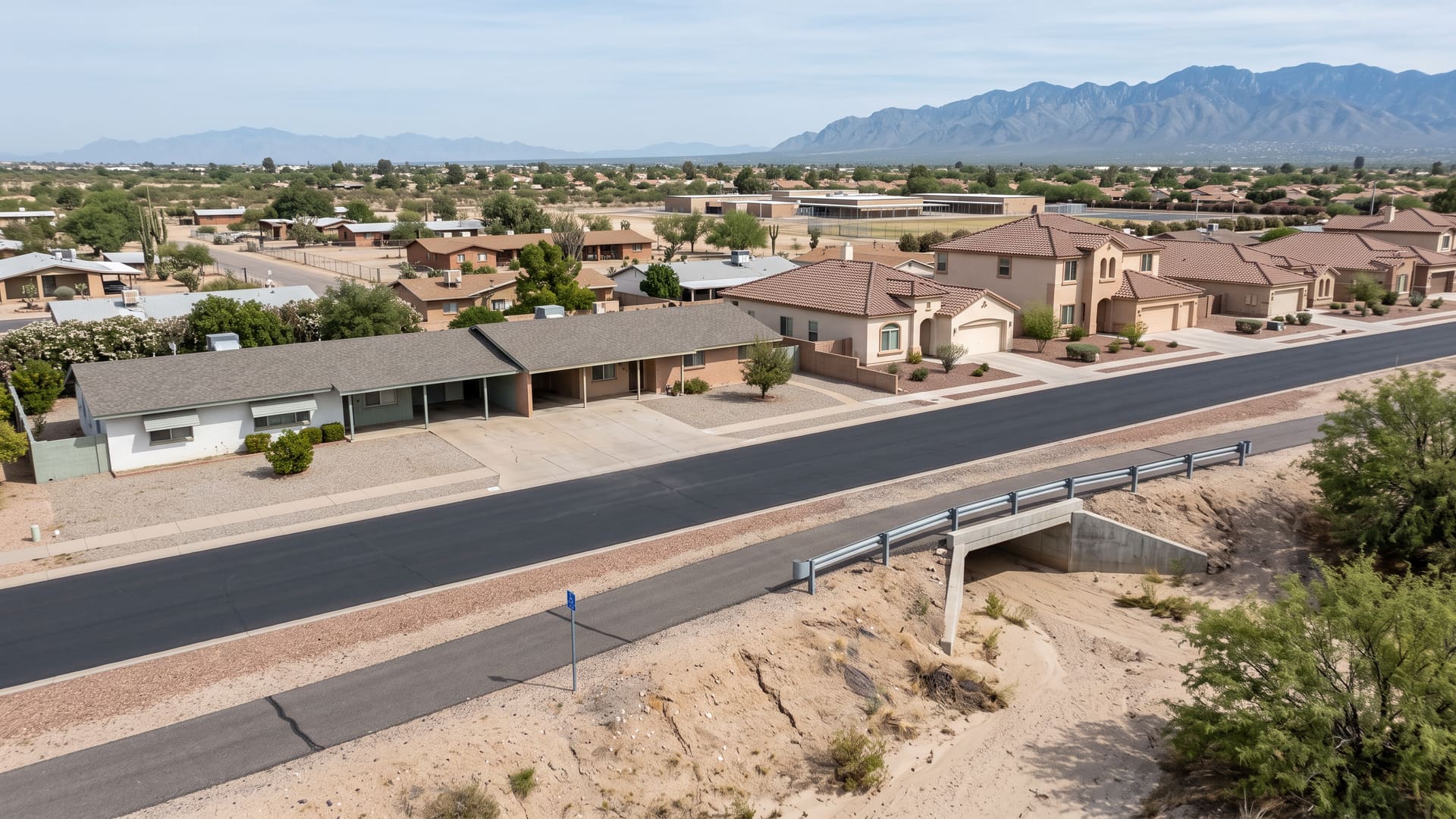
Harrison East-South is one square mile that was built twice, two decades apart, and the gap is legible on the ground.
Key facts
- Jurisdiction
- Tucson, Arizona — incorporated city, Pima County
- Average sale price
- $336,000
- Price range
- $225K – $525K
- School district
- TUSD (Dunham & Soleng Tom Elementary, Secrist Middle, Santa Rita High)
- Approximate population
- ~3,700
- Approximate number of homes
- ~1,600 homes
What defines this area
- The Old Spanish Trail corridor crossing it diagonally
- A paved shared-use path for walking, cycling and horses
- Discovery Ridge's acre-scale lots platted in 1973
- Dunham Elementary School inside the boundary
- A square mile platted in two waves, 1971-1976 and 1998-2006
- Houses built 1971-2016 to a median year of 1999
- Living areas roughly 1,000-2,900 sq ft, median near 1,570
- Eleven townhouses, every one built between 1974 and 1983
- 1,118 R-1 parcels, the dominant zoning district
- Braewood Terrace, Stonegate and Village Green platted 1971-1974
- Twenty-Nine Palms platted 1973 and 1976
- Rincon Shadows and Mirabella platted 1998
- Arizona La Victoria and Rancho Paraiso platted 2000-2004
- The Houghton Greenway along the eastern edge
- Robb, Este and Hidden Hills Washes crossing the ground
- Soleng Tom and Dunham attendance areas split on Old Spanish Trail
- 22nd Street north, Golf Links south, Harrison west, Houghton east
- A complete public-land-survey section, number 23
- 640.63 acres, 0.1% off a statutory section
- The City's registered Old Spanish Trail neighborhood association
- No Davis-Monthan noise district over any of it
- Wholly inside the City of Tucson, entirely in Ward 4
About Harrison East-South
Harrison East-South is one square mile that was built twice, two decades apart, and the gap is legible on the ground. Pima County records 22 plats wholly inside it: nine filed between 12 April 1971 and 29 April 1976 — Braewood Terrace, Stonegate, Village Green, Twenty-Nine Palms, Discovery Ridge and a single-lot Knolls filing — then nothing at all for twenty-one years and ten months, then twelve filed between 4 March 1998 and 11 July 2006, among them Rincon Shadows, Mirabella, Harrison Village, Ocotillo Cove, Spanish Trail, Arizona La Victoria, Spanish Trail Vista, Houghton Village and Rancho Paraiso, and since then one two-lot split on Harrison Road in October 2018. The census estimate over the same ground counts the same shape from the other side: of 1,606 housing units, 92 predate 1970, 559 date from the 1970s, the 1980s fall away to 169, and then 284 and 502 arrive in the 1990s and 2000s. So does the closing record. The 137 closings recorded inside this boundary over the last three years ran $225,000 to $525,000 against a $322,500 median and a $335,866 average on a $328,000 list median, and the houses behind them were built between 1971 and 2016 to a median year of 1999 — a median that sits in the second wave while the range still starts in the first. They took a median 28 days on market against 31 cumulative at a sale-to-list ratio of 0.99; 27 of the 137 closed above asking and 47 took a price reduction. Living areas run 1,024 to 2,917 square feet with a 1,571-square-foot median, and the median price per square foot was $210.12. What is unusual is where the oldest houses sit in that record. Across the six best-fit price bands the median year built climbs — 1977.5, 1982, 1999, 2001, 2000 — and then falls back to 1977 in the top band, the eleven closings at $450,000 and above, where median living area is 2,138 square feet and the median price per square foot is $226.11, the highest of any band. Discovery Ridge is why, and the county's own layers say so rather than the inference resting on the prices: that plat covers 143.25 acres recorded in May 1973, and 120 of the section's 143 RX-2 parcels lie wholly inside it on 83.47 acres, about 0.70 acres apiece against the 0.18 that the 1,118 R-1 parcels making up most of the rest average. Zoning across the whole square mile is 1,118 parcels R-1, 209 R-2, those 143 RX-2, 26 O-3, 17 C-1, nine SR, seven PAD-25 over 58.05 acres and one C-2 parcel, on 1,530 parcels that lie wholly inside and read Tucson on the county's jurisdiction field without exception. Two tiers sit inside the closing record. 126 of the 137 were detached houses, closing at a $327,750 median on a 1,607-square-foot median at $210.04 a square foot and built to a median year of 1999; eleven were townhouses, closing at $277,500 on 1,333 square feet at $217.31 a square foot, and every one of the eleven was built between 1974 and 1983, so the attached tier here belongs entirely to the first wave. No condominium closed at all. The boundary is a complete public-land-survey section. Pima County maps it as Section 23 of Township 14 South, Range 15 East, marked a complete fraction and carrying 1.001 square miles on the county's area field, and integrating the LiveBy ring on the WGS84 ellipsoid gives 640.63 acres — 1.00099 square miles on a 4.002-mile perimeter, six-tenths of an acre over the statutory 640. The section's own ring and the LiveBy ring are the same outline to 3.35 metres at the worst vertex. Four arterials bound it and all four are on the county's major-street layer: East 22nd Street on the north, carried at 32.206308 to 32.206338 against a ring edge at 32.20633; East Golf Links Road on the south at 32.191750 to 32.191783 against 32.19176; South Harrison Road on the west at -110.789751 to -110.789712 against -110.78975; and South Houghton Road on the east at -110.772702 against -110.77270. A fifth road crosses the middle and is the reason this square mile does not read as a grid. East Old Spanish Trail meets 22nd Street about a fifth of a mile east of Harrison, runs south-east on a bearing near 134 degrees and leaves through the Houghton Road edge, 1.10 miles of mapped centerline inside the section, and the City maintains an eight-foot hard-surface shared-use path beside it, open and marked for walking, bicycles, horses, dogs and accessibility; an eleven-foot hard-surface Houghton Greenway and a ten-foot soft-surface Houghton Road path run beside Houghton Road along part of the eastern edge. Public open space is otherwise almost absent. The county's park layer returns one polygon wholly inside, 5.80 acres carrying the name of Dunham Elementary School, plus five strips of the Old Spanish Trail Greenway totalling 2.19 acres — 7.99 acres in all, 1.2% of the section, where the section three miles south-west at Groves Lincoln Park is more than a third parkland. Twelve mapped wash reaches cross the ground: Robb Wash at a 75-foot setback in the 1,000-to-2,000-cubic-feet-per-second class with a second reach at 25 feet, Hidden Hills Wash and Este Wash at 50 feet in the same class, Rolling Hills, Wrightstown (Banff) and Deer Trail Washes at 25 feet under 500 cubic feet per second, and five unnamed reaches at 25 feet; the county's major-wash layer returns a single reach here and records its bank material as natural. The whole of it is City of Tucson and one council ward: every one of the 1,530 contained parcels reads Tucson, and all 25 points of an interior grid return Ward 4, with Ward 2 covering the ground immediately north and west of it and no interior point of it. The county maps 1,421 building footprints wholly inside and 1,524 official address points across 79 street names, 1,512 of them in ZIP 85748 and twelve in 85730. School assignment splits on the diagonal rather than on a section line. All 25 interior points return Tucson Unified, Secrist Middle School and Santa Rita High School, and the elementary assignment divides between Soleng Tom to the north-east and Dunham to the south-west along a line whose vertices sit between 0.1 and 1.1 metres from the Old Spanish Trail centerline — the attendance boundary is the road. Dunham Elementary School itself stands inside the section at 9850 East 29th Street. LiveBy's school tool returns exactly those four schools and agrees with the county on all four. The two records still disagree about two grade spans, giving Soleng Tom as PK through 6 against the county's K through 5 and Santa Rita High as 8 through 12 against the county's 9 through 12, and this page reports the disagreement rather than choosing. The City of Tucson has no registered association called Harrison East-South — that name is LiveBy's label for the section. Exactly one registered association covers this ground, Old Spanish Trail, listed active in Ward 4, and it is the same outline: all 25 interior grid points fall inside it, its worst vertex sits 6.25 metres off the LiveBy ring, and its recorded area of 640.29 acres is within 0.05% of the ring's. Three more associations — Eastside, South Harrison and Houghton East — touch the edges and cover no interior point. The ground on either side is two of this site's own pages: Eastside is the section immediately north across 22nd Street, and South Harrison lies south across Golf Links Road. Davis-Monthan Air Force Base's noise control districts, its accident potential and clear zones and its avigation easement and disclosure areas reach none of this square mile.
Harrison East-South is a suburban neighborhood in the City of Tucson, on the southeast side of metro Tucson, Arizona, served by TUSD (Dunham & Soleng Tom Elementary, Secrist Middle, Santa Rita High). Homes trade in the $225K – $525K range, with an average sale price of $336,000 across roughly 1,600 homes and a population of about 3,700. Kyle Berglund, REALTOR® at Tierra Antigua Realty, represents buyers and sellers here — call (520) 250-8904.
Compare nearby Tucson neighborhoods
- Rita Ranch — Affordable, average $370,000
- Vail — Suburban, average $421,000
- Del Webb at Rancho del Lago — 55+, average $385,000
- Civano — Eco-Friendly, average $460,000
- Tanque Verde — Suburban, average $560,000
- Corona de Tucson — Affordable, average $380,000
- Rocking K — New Build, average $415,000
- Rancho Vistoso — Suburban, average $505,000
Frequently asked questions
What city is Harrison East-South in?
Harrison East-South is in the City of Tucson, Arizona. Jurisdiction: Tucson, Arizona — incorporated city, Pima County.
What is the average home price in Harrison East-South, Tucson?
The average sale price in Harrison East-South is approximately $336,000, with homes generally ranging from $225K – $525K. These are rounded, long-run estimates aggregated from MLSSAZ closed sales through the LiveBy data connection, over this neighborhood's own boundary, for general orientation — not a current-month figure. Averages are means and can be skewed by a small number of high-value sales, so individual home values vary materially.
What school district serves Harrison East-South?
Harrison East-South is served by TUSD (Dunham & Soleng Tom Elementary, Secrist Middle, Santa Rita High). Confirm exact school assignments by specific address, as boundaries can change.
Is Harrison East-South a good place to live?
Harrison East-South is a suburban neighborhood in the City of Tucson, on the southeast side of metro Tucson, Arizona, known for the Old Spanish Trail corridor crossing it diagonally, a paved shared-use path for walking, cycling and horses, Discovery Ridge's acre-scale lots platted in 1973, Dunham Elementary School inside the boundary. Harrison East-South is one square mile that was built twice, two decades apart, and the gap is legible on the ground. It has an approximate population of ~3,700 across roughly ~1,600 homes.
What kind of homes are for sale in Harrison East-South?
Harrison East-South is a suburban submarket where homes generally trade between $225K – $525K, with an average sale price of $336,000.
Who can help me buy or sell a home in Harrison East-South?
Kyle Berglund, a licensed Arizona REALTOR® (License #SA668710000) at Tierra Antigua Realty, specializes in Harrison East-South and the greater Tucson area. Call (520) 250-8904 or email contact@kyleberglund.com for a free consultation.