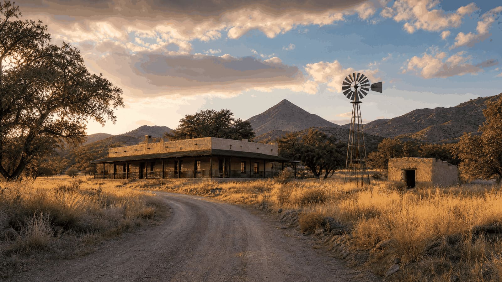
You Can Rent This 1904 Gold Camp Near Tucson
Five adobe buildings from a failed 1904 gold venture sit 45 miles southeast of Tucson, on a stretch of the Arizona Trail rebuilt this year.
The headquarters building takes overnight reservations through a federal booking site. Getting there costs one exit off I-10, 21 miles of state highway and about five miles of graded dirt.
You can rent a ghost town. This one is about 45 miles southeast of Tucson, in a gulch in the Santa Rita foothills, and five adobe buildings are still standing in it. The largest has a wrap-around porch with rocking chairs and beds for five inside; it went up in 1904 as the headquarters of a gold company that lasted roughly two years. Two things make August a good month to drive out: the camp sits at 5,230 feet, and the trail running past its front steps was rebuilt from dirt road to purpose-built singletrack between last October and this spring.
- Sleeps 5
- Capacity of the Kentucky Camp headquarters, bookable overnight through Recreation.gov
- 5,230 ft
- Elevation at the Kentucky Camp trailhead, in grassland rather than saguaro country
- $175,000
- Sunk into a pipe-and-ditch water system that never made the mine pay
- 10.7 miles
- New Arizona Trail singletrack built past the camp, between two forest road crossings
The Gold Was Real. The Water Was the Problem.
Prospectors found placer gold on the east slope of the Santa Ritas in 1874 — A. Smith gets the credit — and the Greaterville Mining District was organized on March 17, 1875. Several hundred miners worked the gulches over the next decade, turning up nuggets worth $1 to $50 apiece and, by one report, a single 37-ounce find. A 1929 accounting put the district's lifetime total at $680,000. What the district never had was water. Miners hauled it in on burros, and by 1900 the easy placer ground was worked out.
Mining engineer James Stetson thought he could fix that. His plan was to catch seasonal runoff from streams on the far side of the range and store enough of it to run hydraulic mining ten months a year. A Californian named George McAneny put up $150,000 in 1902 and took the presidency of the new Santa Rita Water and Mining Company, with Stetson managing. They picked Boston Gulch to mine and Kentucky Gulch for headquarters, and spent $175,000 on more than eight miles of pipe and ditch. By the end of 1904 the water system was complete and hydraulic mining had started.
Then the Engineer Went Out a Window
The afternoon before a May 22, 1905 stockholders' meeting at the Tucson office of attorney Samuel Kingan, Stetson fell, jumped or was pushed from a third-story window of the Santa Rita Hotel downtown, and died. Which of the three it was has never been established. The company's productive stretch amounts to 1904 through 1906, and the mining operation was abandoned by 1912. Cattle ranching kept the buildings occupied from the 1920s into the 1960s. The Forest Service took the property in a 1989 land exchange, and the Kentucky Camp Historic District went on the National Register in 1995.
What's Standing, and What You Can Book
- The Headquarters (Sleeps 5, Recreation.gov #233169, No indoor running water): The main adobe building takes reservations through Recreation.gov. It sleeps five on two twin beds, a twin bunk and a full futon, with electricity, propane heat, a small refrigerator, microwave, hot plate, dishes and cookware. Water, bedding and towels are yours to bring; a vault toilet, an outdoor sink and a stall for a solar shower are outside. It can also be booked for day use by groups up to 50.
- The Other Four (Two cabins, Assay office, Barn ruins): Kentucky Camp is five adobe structures in all: the headquarters, two cabins, the assay office and what is left of a barn. The Forest Service runs the site as an interpretive mining site with picnic tables and potable water. A volunteer caretaker is often on hand to answer questions — often, not always, because the position is unpaid. The nonprofit Friends of Kentucky Camp organizes the work days that keep the adobe standing.
- Getting There (I-10 Exit 281, SR 83 south, ~5 miles of dirt): I-10 east from Tucson about 22 miles to Exit 281, then State Route 83 south roughly 21 miles to Gardner Canyon Road, then about five miles of graded dirt on forest roads. Arizona Highways clocks the trip at 49 miles one way. A sedan will manage it in dry weather; high clearance is the safer choice in monsoon season.
The Trail Past the Porch Is New
Passage 5 of the Arizona National Scenic Trail runs 13.5 miles from Gardner Canyon Road north to Oak Tree Canyon, and reaches Kentucky Camp 3.7 miles in. A good share of that passage used to follow dirt roads. The Arizona Trail Association has been moving those sections onto dedicated singletrack, and the reason it gives is traffic: side-by-side off-road vehicles have multiplied on the forest roads the trail was sharing. Contractor Flagline Trails broke ground October 1 on 10.7 miles between Oak Tree Canyon Road and Gardner Canyon Road — the stretch the association calls the Santa Rita Foothills Traverse — and expected to finish in March or April. At the $20,000 to $30,000 per mile the association budgets for new trail, that is roughly $214,000 to $321,000 of construction, paid for out of memberships, donations, business partnerships and state and federal funding.
Why It's Worth the Drive in August
Elevation, mostly. Fifty-two hundred feet is enough to trade saguaro for grassland, juniper, oak and manzanita, with Mount Wrightson's pyramid on the skyline. Monsoon season runs June 15 through September 30 in the Tucson forecast area, and this is the stretch of the calendar when that grassland is green rather than gold. Carry your own water anyway — there is potable water at the camp, but nothing for sale anywhere near it. Check road conditions before you commit to the last five miles; the dirt is graded, not paved, and a storm changes it.
Quick reference (August 16, 2026): Kentucky Camp is a Coronado National Forest interpretive site in the Santa Rita foothills, roughly 45 miles southeast of Tucson via I-10 Exit 281 and State Route 83. Five adobe buildings, picnic tables, potable water and a vault toilet; the headquarters rents overnight and for day-use groups up to 50 through Recreation.gov, campground 233169. Arizona Trail Passage 5 passes the camp 3.7 miles in from the Gardner Canyon Road trailhead at 5,230 feet. Road conditions, caretaker presence, fees and reservation availability all change — confirm with the Nogales Ranger District at (520) 761-6000 and on Recreation.gov before you drive out.
A Historic District You Can Rent
Kentucky Camp is a National Register historic district that rents its main building the way a campground rents a site — a Forest Service transaction rather than a resort booking. If that appeals, the calendar for campground 233169 on Recreation.gov is most of the planning. The other half of the story is the money. Something on the order of a quarter-million dollars of new singletrack went into this corridor this year, along the same State Route 83 that runs past Corona de Tucson and the southeast edge of the metro. Trail access is easy to overlook when you are comparing addresses on that side of the valley, and it just got ten miles better.
Sources
USDA Forest Service, Coronado National Forest — "Recreation Site: Kentucky Camp" — fs.usda.gov/r03/coronado/recreation/kentucky-camp — accessed August 16, 2026 (for the five adobe buildings — headquarters, two cabins, assay office and barn remains — the site's operation as an interpretive mining site, the volunteer caretaker who may not always be present, the picnic tables and potable water, and the headquarters' availability for day use by up to 50 people).
Recreation.gov — "Kentucky Camp Cabin And Headquarters Building, Coronado National Forest" (campground 233169) — recreation.gov/camping/campgrounds/233169 — accessed August 16, 2026 (for the buildings serving as Santa Rita Water and Mining Company headquarters from 1902 to 1906 and as a cattle ranch from the 1920s through the 1960s, the Forest Service's 1989 acquisition, the cabin sleeping up to five on two twin beds, a twin bunkbed and a full-sized futon, the electricity and propane heat with no indoor running water, the vault toilet, solar-shower stall and outdoor sink, the kitchen equipment, and the list of what guests must bring).
Arizona Trail Association — "Passage 5: Santa Rita Mountains" — aztrail.org/explore/passages/passage-5-santa-rita-mountains — accessed August 16, 2026 (for the 13.5-mile passage from Gardner Canyon Road to Oak Tree Canyon, Kentucky Camp at 3.7 miles in, the singletrack built between October 2025 and May 2026, the grassland-juniper-oak-manzanita terrain, and the views of Mount Wrightson).
Arizona Trail Association — "Arizona Trail reroutes dirt road sections onto new singletrack as side-by-side traffic explodes" — aztrail.org/arizona-trail-reroutes-dirt-road-sections-onto-new-singletrack-as-side-by-side-traffic-explodes — accessed August 16, 2026 (for the 10.7 miles under construction from Oak Tree Canyon Road to Gardner Canyon Road as part of the Santa Rita Foothills Traverse, machine contractor Flagline Trails breaking ground October 1 with a March-or-April finish expected, the growth in side-by-side traffic as the reason for moving off dirt roads, the $20,000-to-$30,000-per-mile trail construction budget, and the association's reliance on business partnerships, donations, membership and federal and state funding).
Arizona Daily Star / tucson.com — "Mine Tales: The ghost towns of Greaterville and Kentucky Camp" — tucson.com/news/local/mine-tales-the-ghost-towns-of-greaterville-and-kentucky-camp/article_5027b9be-71dc-5951-b11d-665737ef5309.html — accessed August 16, 2026 (for A. Smith's 1874 discovery of the Greaterville placers 45 miles southeast of Tucson, the district's organization on March 17, 1875, the several hundred miners, the nuggets valued at $1 to $50 apiece and the reported 37-ounce nugget, the $680,000 total reported in 1929, the burros that hauled water, the depletion of the placers between 1886 and 1900, and the $175,000 the 1902 company spent developing waterways to Kentucky Camp).
Friends of Kentucky Camp — kentuckycamp.org and the Kentucky Camp Timeline at kentuckycamp.org/kc_timeline.html — accessed August 16, 2026 (for Stetson's 1902 plan to channel seasonal runoff into a reservoir holding ten months of water, George McAneny's $150,000 and presidency of the Santa Rita Water and Mining Company, the Boston Gulch mining site and Kentucky Gulch headquarters, the water system's completion by the end of 1904, the May 22, 1905 stockholders' meeting at attorney Samuel Kingan's office, Stetson's fall from a third-story window of the Santa Rita Hotel, and the nonprofit's work days and preservation role with the Coronado National Forest).
Wikipedia — "Kentucky Camp, Arizona" — en.wikipedia.org/wiki/Kentucky_Camp,_Arizona — accessed August 16, 2026 (for the camp's construction in 1904, the abandonment of the mining venture by 1912, the 1989 Forest Service land exchange, and the Kentucky Camp Historic District's 1995 listing on the National Register of Historic Places).
USDA Forest Service, Coronado National Forest — "Kentucky Camp Connector #163" — fs.usda.gov/r03/coronado/recreation/trails/kentucky-camp-connector-163 — accessed August 16, 2026 (for the 5,230-foot trailhead elevation and the roughly five miles of Forest Service Road 163 between Gardner Canyon Road and the camp).
Outdoor Project — "Arizona Trail Passage 5: Santa Rita Mountains" — outdoorproject.com/az/arizona-trail-passage-5-santa-rita-mountains — accessed August 16, 2026 (for the wrap-around porch with rocking chairs and the potable water and vault toilets at Kentucky Camp as the passage's resupply point).
Arizona Highways — "Kentucky Camp" — arizonahighways.com/kentucky-camp — accessed August 16, 2026 (for the 49-mile one-way drive from Tucson, the route of I-10 east about 22 miles to State Route 83 and 21 miles south to Gardner Canyon Road, the final stretch of gravel, and the high-clearance recommendation).
National Weather Service, Tucson — "Monsoon Information Page" — weather.gov/twc/MonsoonInfo — accessed August 16, 2026 (for the June 15 through September 30 monsoon season in the Tucson forecast area).
All details are current as of August 16, 2026; road conditions, reservation availability, fees, hours and trail status change, so confirm current information with the Coronado National Forest and Recreation.gov before relying on any single figure. This post is for informational purposes only and is not an offer to sell or a solicitation of an offer to purchase real estate. Kyle Berglund and Tierra Antigua Realty fully support and comply with the Fair Housing Act and the Equal Opportunity Act.
Topics
- Hidden Gems
- Kentucky Camp
- Santa Rita Mountains
- Arizona Trail
- Coronado National Forest
- Greaterville
- Sonoita
- Corona de Tucson
- Day Trip
- Tucson