The Tucson Streets That Bend Around a Wash
Colonia Solana was platted in 1928 around the Arroyo Chico, not a grid. What 158 acres of curving Tucson streets look like in monsoon season.
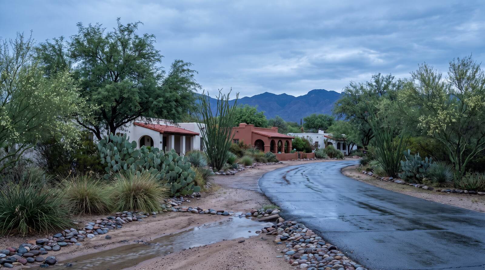
Colonia Solana's 111 houses sit on curving lanes that follow a drainage instead of a grid — a 1928 choice by a landscape architect, and the reason monsoon season reads differently here than four blocks north.
Turn south off Broadway anywhere between Country Club Road and Randolph Way and the street stops going straight. Midtown Tucson is a grid — section lines, half-mile blocks, right angles you can set a watch by. Inside Colonia Solana the pavement starts curving and does not stop, because in 1928 a landscape architect decided the streets should follow the Arroyo Chico rather than cross it.
- 1928
- Year Stephen Child laid out the Colonia Solana plan
- 111
- Distinctive single-family residences the district record counts
- 158
- Acres between Broadway, Country Club, Randolph Way and Camino Campestre
- 1989
- Year the district was listed on the National Register of Historic Places
A Landscape Architect Got There Before the Engineers
Stephen Child trained under Frederick Law Olmsted, and he brought that school of thought to 158 acres of Sonoran desert east of what was then the edge of town. The conventional move in 1928 would have been to scrape the site flat, run the grid through it and sell lots. Child did close to the opposite: he kept the arroyo, ran curvilinear streets alongside it, set five small triangular parks where the lanes intersect, and platted lots large enough to keep the desert vegetation standing on them. The district record describes this as developers embracing the desert landscape possibly for the first time in Tucson. Its period of significance runs from 1928 to 1941, and the houses standing in it range from Spanish Colonial Revival to post-World War II Ranch, several by architects including Roy Place and Arthur T. Brown.
The Wash Is the Whole Design
The Arroyo Chico is not a decorative feature. It is a working desert drainage that carries stormwater west toward the Santa Cruz River, and inside Colonia Solana it functions as a linear riparian corridor — vegetation dense enough to hold birds and wildlife in the middle of the city. That is the payoff of Child's plan and also its constraint. The same channel that gives the district its character is the reason the streets bend, the reason the lots are shaped the way they are, and the reason a buyer here reads a floodplain map before a floor plan.
- El Encanto Estates (North across Broadway, Historic district): A planned low-density subdivision from the same era, laid out formally where Colonia Solana was laid out loose. Broadway is the seam between two very different ideas about a street.
- Reid Park (East and south, City parkland): Across Randolph Way and Camino Campestre. The district's back edge opens onto public recreation land instead of onto more houses — rare this deep into midtown.
- The Country Club edge (West, Conventional grid): Cross South Country Club Road and the conventional Tucson street pattern picks right back up. It is the best place to stand and see what Child chose not to do.
What Pima County Built Downstream
A neighborhood built around a wash inherits a drainage problem the moment the city grows around it, and the public answer took three decades to build. The Tucson Drainage Area / Arroyo Chico Multi-Use Project covers roughly 4.8 miles of the Tucson Arroyo and Arroyo Chico, from Alvernon Way west to the confluence with the Santa Cruz River near St. Mary's Road, undertaken jointly by the Pima County Regional Flood Control District and the City of Tucson with the U.S. Army Corps of Engineers. Phase 1, the Randolph South detention basins, was completed in April 1996. Phase 2A, the Cherry Field detention basin, followed in December 2008, and Phase 2B, the Park Avenue detention basin complex, in December 2012. In 2022 the partners reconsidered the need for additional channel capacity and concluded the project's design intent had been met without building the third increment. The practical translation: the water leaving this part of the city in a storm has somewhere engineered to go, and has since before most current owners bought in.
Three Things to Check Before You Buy on a Curve
First, the floodplain. A lot fronting or backing the arroyo can sit partly inside a mapped flood hazard area, and that drives both insurance and what may be built on it. The Pima County Regional Flood Control District's floodplain mapping is the thing to pull, not a listing remark. Second, which review actually applies. National Register listing and the City of Tucson's own historic preservation zoning are two different designations, and which one touches a given property decides whether exterior work needs design review before a permit issues. Ask the City's historic preservation office rather than assuming the National Register listing settles it — a renovation schedule here can be a permitting schedule first. Third, the lots. Child platted them large and irregular to fit the terrain, which means two houses on the same lane can have very different buildable footprints. None of the three shows up in a square-footage figure.
Quick reference: Colonia Solana runs from East Broadway Boulevard south to East Camino Campestre, between South Country Club Road and Randolph Way. 158 acres, 111 single-family residences, laid out in 1928 to Stephen Child's plan, listed on the National Register of Historic Places in 1989, with a period of significance running to 1941.
Drawn by an Architect, Not a Surveyor
Most Tucson neighborhoods were drawn by a surveyor and handed to a builder. This one was drawn by a landscape architect who looked at a wash and treated it as the plan rather than the obstacle, and ninety-eight years later the evidence is still legible from the driver's seat: the curve of the lane, the mesquite left standing, the five small triangles of park where the streets meet. Late August is the right time to walk it. Catch it in the day or two after a monsoon storm and the arroyo is running or has just run; even between storms the vegetation is at its densest, and the reason the streets bend is visible instead of theoretical.
Sources
Living Places — "Colonia Solana Residential Historic District, Tucson City, Pima County, Tucson, AZ, 85716" — livingplaces.com/AZ/Pima_County/Tucson_City/Colonia_Solana_Residential_Historic_District.html — accessed August 22, 2026 (for the 1928-1941 period of significance, the 111 distinctive single-family residences, the 158 acres, the boundaries at East Broadway Boulevard, South Country Club Road, East Camino Campestre and Randolph Way, the five small triangular parks and intersecting curvilinear streets, Stephen Child's 1928 design incorporating the Arroyo Chico as desert riparian habitat for birds and wildlife, and the 1989 listing on the National Register of Historic Places). City of Tucson Historic Preservation Office — "Colonia Solana Residential Historical District, Tucson, Arizona" (description) — tucsonaz.gov/files/sharedassets/public/v/1/city-services/planning-development-services/historic-preservation/documents/coloniasolanarhd1989_1_descr2.pdf — accessed August 22, 2026 (for the district's setting against El Encanto Estates to the north across Broadway, the conventional Tucson residential neighborhood west across Country Club, and Reid Park east and south across Randolph Way and Camino Campestre). City of Tucson Historic Preservation Office — "Colonia Solana Residential Historical District — Statement of Significance" — tucsonaz.gov/files/sharedassets/public/v/1/city-services/planning-development-services/historic-preservation/documents/coloniasolanarhd1989_2_significance2.pdf — accessed August 22, 2026 (for the significance of the subdivision plan and the developers' embrace of the desert landscape). SAH Archipedia — "Colonia Solana" — sah-archipedia.org/buildings/AZ-01-019-8006 — accessed August 22, 2026 (for Stephen Child's study under Frederick Law Olmsted and for the range of architectural styles from Spanish Colonial Revival to post-World War II Ranch houses by architects including Roy Place and Arthur T. Brown). Pima County — "Arroyo Chico Multi-Use Project" — pima.gov/1525/Arroyo-Chico-Multi-Use-Project — accessed August 22, 2026 (for the joint Pima County Regional Flood Control District, City of Tucson and U.S. Army Corps of Engineers undertaking covering approximately 4.8 miles of the Tucson Arroyo and Arroyo Chico Wash from Alvernon Way to the confluence with the Santa Cruz River near St. Mary's Road; for Phase 1, the Randolph South Detention Basins, completed April 1996; Phase 2A, the Cherry Field Detention Basin, completed December 2008; and Phase 2B, the Park Avenue Detention Basin Complex, completed December 2012; and for the 2022 reconsideration of additional channel capacity, which concluded project design intent was met without construction of increment 3). All figures are current as of August 22, 2026; floodplain mapping, historic preservation review requirements and district boundaries change, so readers should confirm current information with the Pima County Regional Flood Control District, the Pima County Assessor and the City of Tucson Historic Preservation Office before relying on any single figure. This post is for informational purposes only and is not an offer to sell or a solicitation of an offer to purchase real estate. Kyle Berglund and Tierra Antigua Realty fully support and comply with the Fair Housing Act and the Equal Opportunity Act.
Topics
- Local Insights
- Colonia Solana
- Historic Districts
- Arroyo Chico
- Stephen Child
- Monsoon
- Reid Park
- Tucson