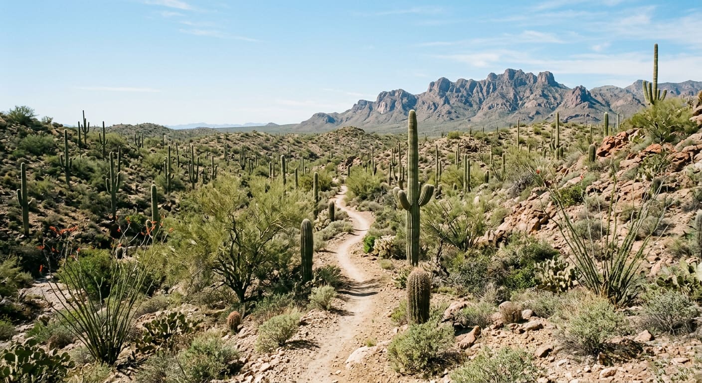
Sweetwater Preserve Packs 15 Miles of Saguaro Trail Into 880 Acres
Pima County's 880-acre Sweetwater Preserve in the Tucson Mountains: where to park, which of its 16 mapped trails to start on, loop lengths and the park rules.
Pima County bought this Tucson Mountains foothill parcel with 2004 bond money. Its trail map runs from a 0.1-mile link to a 3.8-mile loop, and the rules differ from a city park's.
West of Interstate 10, a parking lot on Tortolita Road opens onto hillsides thick with saguaros. Sweetwater Preserve is a Pima County Natural Preserve and Trails Park — not a city park, not part of Saguaro National Park — and it has no visitor center, no entry fee and no drinking water. What follows is which loop to start on, where to park, and the two rules most likely to surprise a first-time visitor.
- 880 acres
- Size of the preserve, per Pima County's trails park brochure
- 15 miles
- Trail built by county crews and volunteers
- 16
- Named trails and links on the county trail system map
- 2004
- Year of the Open Space Bond that funded the purchase
Where Is Sweetwater Preserve?
The trailhead is at 4001 N. Tortolita Road, Tucson, 85745, in the eastern foothills of the Tucson Mountains. From I-10, the usual route is west on Camino del Cerro, then north on Tortolita Road to the trailhead lot. The county says Saguaro National Park's Tucson Mountain District and a University of Arizona biological research preserve both sit within about half a mile, and Tucson Mountain Park is a short distance south — so the preserve fills a gap in a chain of protected desert rather than standing alone.
Park only in the designated lot; the county's brochure says trailheads are for access only, and loitering at the trailhead is not allowed. Hours are dawn to dusk. There is no drinking water, so carry what you need for the whole outing.
Which Sweetwater Trail Should You Start On?
The county's trail system map names sixteen trails and connectors, from the 0.1-mile Los Rancheros Link to the 3.8-mile Desperado Loop. Most are short pieces that join into loops, which makes it easy to build an outing of whatever length the morning allows. Desperado is the longest single trail and a reasonable first lap; one trail guide calls it the smoothest in the preserve, following the sides of rolling hills. Black Rock Loop adds 1.6 miles; Saguaro Vista and Red Tail Ridge are 1.2 miles each; Homestead is 1.0.
The shorter named pieces are where the terrain changes. Wildflower Ridge (0.9 miles) is a descent with views across the preserve, Ocotillo Hill runs 0.8 miles, and Lost Arrow, The Spine, Red Canyon, Sun Circle, Night Hawk, Oxbow and Roller Coaster fill in between at 0.3 to 0.6 miles each. Mountain-bike guides describe Lost Arrow and Red Canyon as semi-technical, so a first-time hiker or rider may want to save those for a second visit. Pima County rates the network as suitable for beginner and intermediate mountain bikers.
- Desperado Loop (3.8 miles, Longest trail, Rolling hills): The longest named trail on the county map and the simplest way to see the whole preserve in one lap.
- Black Rock Loop (1.6 miles, Loop, Ocotillo): A self-contained loop that adds distance without repeating Desperado.
- Wildflower Ridge Trail (0.9 miles, Ridge, Views): A short ridge descent with views over the preserve.
What Rules Apply at Sweetwater Preserve?
The trails are open to hikers, trail runners, mountain bikers, equestrians and dogs on a leash. Two rules catch people off guard. Motorized vehicles are banned, and the county's brochure spells out that this includes electric bicycles — a pedal-assist bike that is welcome on many paved paths is not welcome here. Geocaching is also prohibited. Alcohol is not allowed, visitors must stay on designated trails, and removing or disturbing any natural or cultural resource is illegal.
Trail courtesy follows the standard order: everyone yields to people with disabilities, then to horses, then to pedestrians, with cyclists yielding to all. The county asks riders and equestrians to wear helmets, and it warns that cell reception may not always be available. Pick up after your dog and pack out everything you bring in.
Why the Land Is Protected
The preserve was private land until Pima County bought it with 2004 Open Space Bond funds. The county credits the result to a partnership among its parks department, the Tucson Mountains Association, the Trust for Public Land and other community groups. Its stated purpose is to protect wildlife habitat while providing trails: the brochure points to the palo verde and the large saguaros on the hillsides, and to the javelina, coyotes and mule deer a careful visitor may spot. For anyone looking at homes on the west side of the Tucson Mountains, it is a concrete detail about the area — a block of county-owned preserve land, set aside from development, with a public trailhead on Tortolita Road.
Quick reference (October 24, 2026): Sweetwater Preserve, 4001 N. Tortolita Road, Tucson, AZ 85745. Open dawn to dusk, no fee. Leashed dogs allowed; no e-bikes, alcohol or geocaching; no drinking water on site. Pima County Natural Resources, Parks and Recreation: 520-724-5000. Check the county's notices and closures page before you go.
Sources
Pima County — "Sweetwater Preserve" — pima.gov/1292/Sweetwater-Preserve — accessed October 24, 2026 (for the 4001 N. Tortolita Road address, sunrise-to-sunset hours, the 880-plus acres in the eastern foothills of the Tucson Mountains, the 15 miles of trail built by county crews and volunteers, the beginner and intermediate rating, the allowed uses, the nearby Tucson Mountain District, university research preserve and Tucson Mountain Park, and the 2004 Open Space Bond purchase). Pima County Natural Resources, Parks and Recreation — "Sweetwater Preserve Trails Park" brochure, revised June 2023 — pima.gov/asset/e065b2ba-0017-43dc-818e-27cad7773a0b — accessed October 24, 2026 (for the 880-acre figure, the partnership with the Tucson Mountains Association and the Trust for Public Land, the palo verde, saguaros, javelina, coyote and mule deer, the park rules including the electric-bicycle, alcohol and geocaching bans, the trail courtesy order, the safety checklist and the 520-724-5000 number).
Pima County — "Sweetwater Preserve Trail System Map" — content.civicplus.com/api/assets/7a463842-24bd-4ce2-989d-ec6c47777acc — accessed October 24, 2026 (for the sixteen named trails and links and their lengths). Singletracks — "Sweetwater Preserve" — singletracks.com/bike-trails/sweetwater-preserve/ — accessed October 24, 2026 (for the I-10, Camino del Cerro and Tortolita Road approach, and rider descriptions of Lost Arrow and Red Canyon as semi-technical). Hiking Project — "Desperado Loop" — hikingproject.com/trail/7020709/desperado-loop — accessed October 24, 2026 (for Desperado as the smoothest trail in the preserve, following the sides of rolling hills, and the absence of water in the park).
All details are current as of October 24, 2026; trail conditions and closures change, so confirm with Pima County before visiting. This post is for informational purposes only and is not an offer to sell or a solicitation of an offer to purchase real estate. Kyle Berglund and Tierra Antigua Realty fully support and comply with the Fair Housing Act and the Equal Opportunity Act.
Topics
- Hidden Gems
- Sweetwater Preserve
- Tucson Mountains
- Hiking
- Mountain Biking
- Pima County
- Westside Tucson